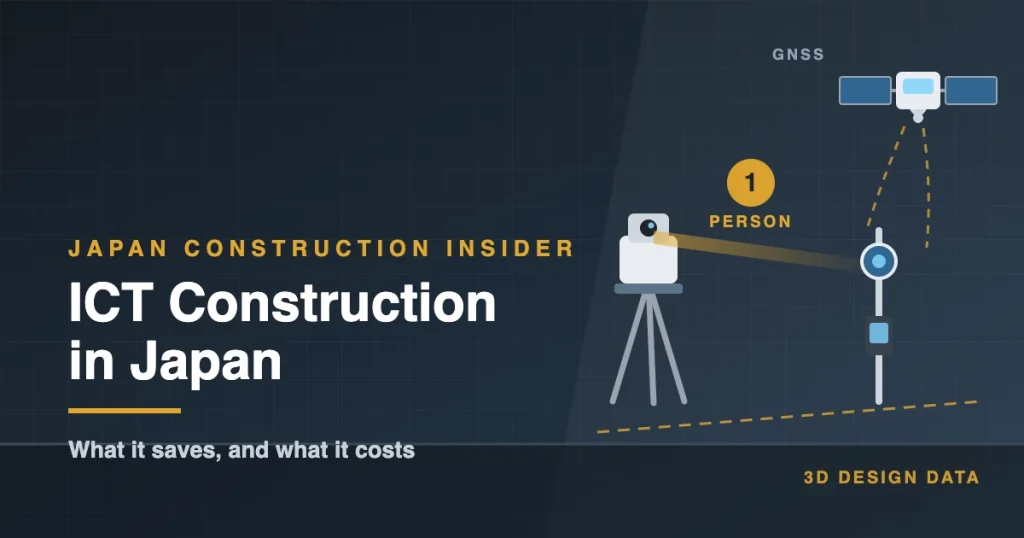
ICT Construction in Japan: What It Saves, and What It Costs
The short version
- ICT construction means working from one set of digital data — the 3D design — through surveying, setting out, earthmoving and checking.
- The tools you will meet: 3D data, satellite positioning, a layout navigator (kui-navi), machines with guidance screens, and drones.
- The biggest change for me was setting out points alone. No surveying contractor to book, nobody pulled off their own work.
- It is not free. Preparing data takes time, the equipment is expensive, and you are slower while you learn.
Hi there, I’m Shirokuma!
Here’s something that changed how I work. Marking out points on site — the job that always needed two people, or a call to a surveying contractor — became something I could do alone, with one machine.
That’s ICT construction. In Japan, it’s the word for using digital data and connected machines to do the work that used to be done by eye, by hand, and by a lot of people.
In this guide to ICT construction in Japan, you’ll learn:
- What Japanese sites mean by “ICT construction,” and where the idea came from
- The tools you’ll actually see on a job site, and what each one does
- Where it saves time and money — and where it doesn’t
I used these tools during my years as a site supervisor. I’ll tell you what genuinely changed, and where the sales pitch and the site reality don’t quite match.
What “ICT Construction” Means in Japan
The short version
In Japan, ICT construction (we say ICT sekō) means using digital data — usually a 3D model of the finished shape — to guide the actual work on site. The same data that the designer draws goes into the survey instruments, into the machines, and into the checks at the end.
The point isn’t the gadgets. It’s that everyone works from one set of data, instead of copying numbers from drawings by hand at every step.
Where it came from
This isn’t something each company invented on its own. Japan’s Ministry of Land, Infrastructure, Transport and Tourism (MLIT) has been pushing it nationally under the name i-Construction, bringing 3D surveying, data-driven machines, and digital checking into public works.
In April 2024, MLIT published the next step, i-Construction 2.0, aimed at automating construction sites, with a target of saving at least 30% of the labor, or improving productivity by 1.5 times, by fiscal year 2040.
Source: MLIT, “i-Construction 2.0” (April 2024) (PDF, in Japanese)
Why Japan pushed so hard
The honest answer is people. Fewer young workers are joining, and experienced workers are retiring. If there are fewer hands, the work has to change — and that’s what I wrote about in my first article.
So when you hear “ICT construction” in Japan, don’t picture a futuristic site full of robots. Picture a normal site where one person can now do what used to take two or three.
ICT Construction Tools You’ll See on Site
Walk onto a Japanese site that uses ICT construction, and here’s what’s actually there.
1. The 3D data
Everything starts here. The design — the finished ground shape, the levels, the positions — is prepared as 3D data rather than only as paper drawings. Nothing else on this list works without it.
2. GNSS (satellite positioning)
GNSS is the family of satellite systems that GPS belongs to. On site, a pole with a receiver on top tells you where you’re standing, to within a few centimeters when it’s set up properly. It’s what lets a machine know its own position on the plan.
Japan also runs its own satellites, the Quasi-Zenith Satellite System (Michibiki), which is designed to improve positioning accuracy over Japan.
Source: Cabinet Office, Quasi-Zenith Satellite System (QZSS)
3. Kui-navi (a layout navigator)
This is the one that changed my daily work. It’s a tripod-mounted instrument that tracks a prism on a pole and tells you, on a handheld screen, exactly where to move to hit the next design point. One person, one machine. I’ll cover this properly in the next chapter.
4. Machine guidance and machine control
Excavators and bulldozers fitted with sensors and a screen in the cab. The design surface appears on that screen, so the operator can see how far the bucket is from the finished level. Some machines go further and control the blade automatically. More on this in chapter 4.
5. Drones
Used to survey the ground from above and produce a 3D model of the site as it is today — which you then compare with the design. I wrote a whole article about that: Construction Drones in Japan.
A note on accuracy
These tools are accurate, but they are not perfect. From my own experience on site, positions set out this way can be off by around 10 mm. For most earthwork and general layout, that’s fine.
For work that needs to be tighter than that — anchor bolts, precast joints, finishing work — I wouldn’t trust the screen alone. Set the point with the instrument, then check it by another method, such as a steel tape from a known reference line, or a total station shot. Two different methods agreeing is what gives you confidence.
This is my experience on the sites I worked on, not a maker’s specification. Conditions, setup, and the instrument itself all affect the result.
How they fit together
The flow is simple, even if the equipment isn’t:
- Survey the site as it is now (drone, GNSS, or a total station).
- Design the finished shape as 3D data.
- Build using that data — the layout navigator for points, machine guidance for earthmoving.
- Check the result against the same data.
The old way did all four steps too. The difference is that the numbers no longer get copied by hand between them — which is where mistakes used to creep in.
Kui-navi: Setting Out Points by Yourself
How we used to do it
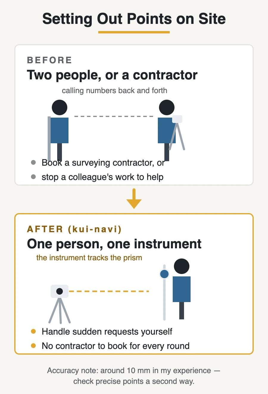
Setting out — marking the exact positions where things will be built — used to be a job for at least two people. One person on the instrument, one person holding the pole or the tape, calling measurements back and forth.
So if I needed points marked, I had three choices:
- Call a surveying contractor (in Japan, we often say sumidashi-ya, the layout specialists) and book them in
- Ask a senior or a junior on my team to stop what they were doing and help me
- Wait until someone was free
None of those are fast. And on a live site, the request usually comes out of nowhere: “Can you mark these positions? We want to start after lunch.”
What changed
With a layout navigator — kui-navi in Japanese — I can do it alone.
The instrument sits on a tripod and automatically tracks a prism on the pole I’m carrying. The design points are already loaded in it. The handheld screen shows me an arrow and a distance: move 1.2 m this way, 30 cm that way, stop — you’re on the point. Mark it, move to the next one.
No second person. No calling ahead. If a request comes in at 10 a.m., the points can be marked before lunch.
Why that matters more than it sounds
Two things changed for me.
I stopped blocking other people’s work. Every time I needed layout done, I used to interrupt someone else’s job, or push my work to whenever help was available. That waiting is invisible on the schedule, but it’s real.
It saves money. If the machine can do the job, you don’t need to hire a surveying contractor for every round of setting out. The instrument costs money up front, but it doesn’t need to be booked, and it doesn’t go home at five.
To be fair, there’s a trade-off. You need the design data prepared and loaded correctly, and you need a known reference to set up from. Get that wrong, and you’ll mark every point wrong — confidently, and fast. Which is exactly why I still check critical points a second way.
Machine Guidance: What the Operator Sees
The problem it solves
Digging to a design level used to be a conversation. The operator digs, someone climbs down into the cut with a staff and a level, measures, waves an arm, and the operator adjusts. Then again. Then again.
It works. But it’s slow, it needs a second person standing near a working machine, and the result depends on how often you stop to check.
How machine guidance works
A machine fitted with machine guidance knows two things: where its bucket or blade is right now, and where the design surface is. Sensors on the arm and a satellite receiver handle the first part; the 3D data handles the second.
The operator gets a screen in the cab showing the design surface and the current position of the cutting edge — how far above or below the target it is. Instead of guessing and checking, the operator can see it.
Machine control goes one step further: the machine adjusts the blade itself to stay on the design surface, with the operator steering.
What it changes on site
- Fewer people near the machine. Nobody has to stand in the cut to check levels as often. That’s a safety gain, not just a speed one.
- Less rework. Digging too deep means bringing material back and compacting it again. The screen makes over-digging much easier to avoid.
- Less waiting. The operator doesn’t have to stop and wait for someone to come and measure.
- Steadier quality between operators. A skilled operator was always good at this. Now a less experienced one can get closer to that standard.
What it doesn’t change
The machine still needs a good operator. It won’t tell you that the ground is unstable, that there’s a buried pipe where the drawing says there isn’t, or that today’s plan doesn’t match what the site actually needs.
And the same accuracy caution applies: for anything tight, check it another way before you sign it off.
Does It Actually Save Time?
Short answer: yes, but not everywhere, and not on day one.
Where it genuinely pays off
- Repetitive setting out. Many points, over and over. This is where working alone instead of in pairs adds up fastest.
- Earthwork. Cut and fill, where a screen in the cab replaces constant checking.
- Sudden requests. The ones that used to mean booking a contractor or borrowing a colleague.
- Fewer separate bills. Not hiring a surveying contractor for every round of layout is a real saving over a long job.
Where it costs you
Preparing the data. Someone has to turn the design into usable 3D data and load it correctly. On a small job, that preparation can take longer than the old method would have taken in total.
Learning it. The first few times are slower than the old way. That’s normal, but it’s a real cost, and people give up here.
Buying it. The instruments and the fitted machines are expensive. Renting is possible, but then you’re back to booking equipment in advance.
Conditions on site. Satellite positioning needs a clear view of the sky, so it struggles indoors, in deep cuts, and between tall buildings. A layout navigator gets around that — it tracks the prism optically instead — but then it needs a clear line of sight between the instrument and the pole. Something always blocks it eventually.
The accuracy limit. As I said earlier, from my experience these positions can be off by around 10 mm. For precise work, you still need a second check.
So when is it worth it?
My honest rule of thumb: the bigger and more repetitive the work, the more you gain. A large earthwork job benefits enormously. A small renovation with twenty layout points may not.
But the part I’d defend even on a small job is being able to work alone. Not because one person is cheaper than two, but because you stop waiting for other people, and you stop interrupting them.
Where It’s Heading
From “digital tools” to “automation”
The first phase of i-Construction was about getting digital data onto the site. The next phase, i-Construction 2.0, is about automating the work itself. MLIT describes three directions: automating the construction work, automating how data moves between steps, and automating site management.
Source: MLIT, “i-Construction 2.0” (April 2024) (PDF, in Japanese)
In practice, that means things like machines that run set tasks with less hands-on control, and site data that flows from survey to design to machine to inspection without someone re-entering it.
What I think it means for people on site
I don’t read this as “the work disappears.” I read it as the work moving.
- More time on preparation. Someone has to build and check the data. Bad data now causes problems faster than bad handwriting ever did.
- More checking, less measuring. The measuring gets automated. Deciding whether the result is acceptable does not.
- More judgment. Ground conditions, weather, the order of work, the thing the drawing didn’t show. No system I’ve used has an opinion about those.
The honest caveat
National targets are targets. What actually reaches a small site in a rural area, and how fast, is another question. The gap between a large civil engineering project and a small building job is wide, and tools reach the big sites first.
Still, the direction is set. If you’re starting out in this industry — in Japan or anywhere — getting comfortable with data is no longer optional, and it’s a lot easier to learn than it looks from the outside.
FAQ
What does ICT construction mean in Japan?
It means using digital data — usually a 3D model of the finished shape — to guide the work on site, from setting out points to moving earth to checking the result. Japan’s government promotes it nationally under the name i-Construction.
Is ICT construction required by law in Japan?
It isn’t a legal requirement for all work in the way that, say, heatstroke prevention is. It’s promoted by the government, and public works projects increasingly expect these methods. On private building jobs, it’s the company’s choice.
What is kui-navi?
Kui-navi is the everyday Japanese name for a layout navigator: a tripod-mounted instrument that tracks a prism on a pole and guides you to design points on a handheld screen. The practical change is that one person can set out points alone, instead of needing two.
Does it replace surveyors?
No. It changes when you need them. Routine setting out can be done by the site team, but surveyors are still needed for control points, complex work, and anything that has to be certified. And someone still has to prepare and check the data.
Can small sites use it?
They can, but the numbers work differently. Preparing the 3D data takes time regardless of job size, so on a small job that preparation can outweigh the savings. Renting equipment for a specific task is a common middle ground.
How accurate is it?
Accurate enough for most layout and earthwork. From my own experience, positions can be off by around 10 mm, so for precise work — anchor bolts, precast joints, finishes — check the point a second way before you commit to it. That figure is my site experience, not a maker’s specification.
Summary
Here’s the short version of what we covered.
- ICT construction in Japan means working from one set of digital data — the 3D design — through surveying, setting out, earthmoving, and checking. The government promotes it as i-Construction, and the next phase, i-Construction 2.0, targets saving at least 30% of the labor, or improving productivity by 1.5 times, by fiscal year 2040.
- The tools you’ll see are 3D data, satellite positioning, a layout navigator (kui-navi), machines with guidance screens, and drones.
- The biggest change for me was being able to set out points alone. No booking a surveying contractor, no pulling a colleague off their own work — and lower costs over the length of a job.
- It isn’t free. Preparing data takes time, the equipment is expensive, and there’s a learning period where you’re slower than before.
- It isn’t perfect, either. From my experience, positions can be off by around 10 mm, so precise work still needs a second check.
If I had to sum it up: these tools didn’t make the work easier. They made it possible to keep going with fewer people — which, in Japan right now, is the problem that actually needs solving.
If you have questions about ICT construction, or about anything else on Japanese job sites, feel free to reach out anytime!
Read next: Construction Drones in Japan: What Sites Use Them For, and the Rules
Also worth reading: BIM in Japan: What Production Design Really Looks Like
Where the machines already are: Construction Robots in Japan: Why Rivals Stopped Competing — the layout robot that marks the floor, and who built it first.
Where the engineering actually went: Seismic Isolation in Japan: Not a Japanese Invention — 5,482 buildings, two earthquakes, and one number I cannot explain.